
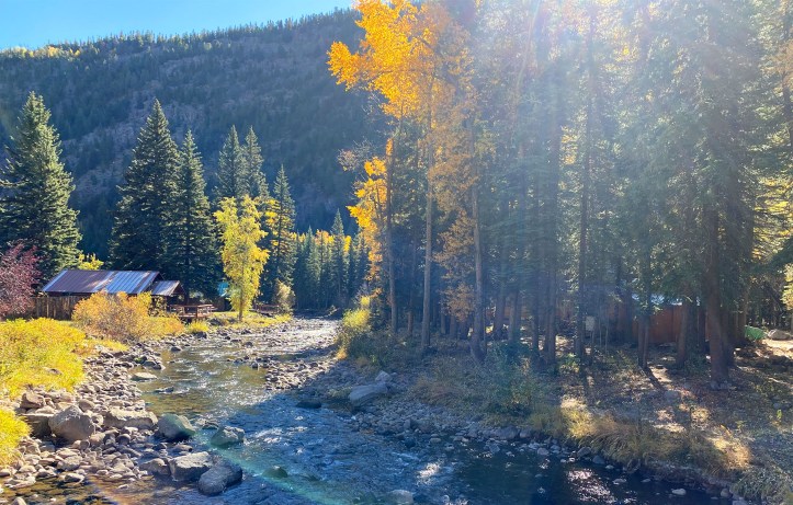
2020…enough said, right? After 7 months of staying home, a handful canceled trips and seemingly endless days bound to the confines of my kitchen table I was more than overdue for a change of scenery. With careful planning and lots of preparation (i.e. packing all of our own food, cooking equipment, linens, etc.) we thought we might be ready to venture out for our first socially-distant something of the year. The drive had to be reasonable, we had to find a place to stay in the “middle of nowhere” and I wanted to visit a National Park. With this criteria in mind, we found the most adorable cabin at Alpine Accents about 20 minutes outside of South Fork in southern Colorado. It was conveniently located off the highway in the heart of the Rio Grande National Forest, just north of Pagosa Springs and the Wolf Creek ski area. More importantly it met my standards for cleanliness (not to say I didn’t sanitize the place twice over before settling in).
While this trip was very different than our original travel dreams for 2020, the area turned out to be a great location for some pretty incredible fall hikes, perfectly timed to the changing leaves at the end of September/early October with temperatures not to warm and not too cold. We put together an itinerary with a good variety of hikes, from low-key lakeside walks to more arduous adventures, which you can read about below. I also highly recommend Colorado Trail Explorer for detailed trail information, interactive routes, offline maps and more. You can explore via the browser version while planning or mobile app while you’re on the trail, both of which proved to be super useful.
Happy hiking, whenever you’re ready. :)
Big Meadows Reservoir
On the first day of our trip we were looking for an easy hike to stretch our legs and kill some time before we were able to check into our cabin. The Big Meadows Loop was a great option conveniently located off highway 160, about 20 minutes outside of South Fork. The trail is a relatively flat loop around the sparkling lake through forests, meadows and streams. Patches of golden aspen trees dotted the mountainside above the water, making for a picturesque and peaceful walk and great introduction to the area.

Trail: Big Meadows Loop Trail #843
Distance: 2.8 mile loop
Location: 37.541746, -106.803000
How to get there: From US 160 head west on Forest Road 410, bearing right on Forest Road 430 until you see the sign for the Big Meadows Reservoir boating area and parking lot
Hope Creek Trail
On the next day we set our sights on the Hope Creek Trail, which runs along the Hope Creek from Forest Road 430 to the Highline Trail #832 at the base of Sawtooth Mountain. We were especially draw to this trail from its scenic description, beginning as a gentile incline before climbing more steeply through meadows and eventually above the tree line. Sadly what we found was a wasteland, completely burnt from forest fires with no shade and little vegetation sans a few young aspens sprouting from the hillside. It was a sobering sight, particularly because we did not come across any information about the extent of the damage beforehand. Unsure of how far the destruction would stretch, we hiked for only about a mile before turning back and seeking an alternative. Unfortunately this trail is best to avoid until the forest has time to rejuvenate.

Trail: Hope Creek Trail #838
Distance: 6.1 miles one-way
Location: 37.554186, -106.803000
How to get there: From US 160 head west on Forest Road 410, bearing right and continuing on Forest Road 430 past the Big Meadows Reservoir towards Shaw Lake (no designated parking but there is a pull out area just up the road from the trailhead)
Archuleta Trail
After our experience with the Hope Creek Trail we headed back down Forest Road 430 to the Big Meadows Reservoir area, which is also the starting point for the Archuleta Trail. The trail begins along the north portion of the lake before continuing into the picturesque forest at a slight uphill incline. It generally follows the Archuleta Creek to Archuleta Lake before connecting with the Continental Divide Trail #813. We enjoyed the pockets of fall colors that dotted the forest landscape and the soothing sound of flowing water (the creek also served as a nice spot for a lunch break along its large flat rocks). The trail was moderate in difficulty but easy to follow with some creek crossings, plenty of shade and lots of deer sightings along the way. We hiked for about 4 miles to the point where the Archuleta Trail connects with the South Fork Trail #750 before turning back.

Trail: Archuleta Trail #839
Distance: 6.9 miles one-way
Location: 37.541746, -106.803000
How to get there: From US 160 head west on Forest Road 410, bearing right on Forest Road 430 until you see the sign for the Big Meadows Reservoir boating area and parking lot
Great Sand Dunes National Park and Preserve
One of the things I was looking forward to the most was our visit to Great Sand Dunes National Park and Preserve. Located about 1.5 hours from South Fork, these Sahara-like sand dunes are a mirage in the mountains that seems to appear out of nowhere as you approach. Visitors can explore the park’s more than 30-square miles of dunefields on foot or by sled, splash around in the Medano Creek (seasonally) or venture to other hiking areas around the park. With no designated trail we set out towards High Dune, which is actually the second tallest dune in the park at 699 feet (the tallest is Star Dune at 750 feet). The climb was more grueling than we expected but it made for an exhilarating and exciting experience. You can read more about visiting Great Sand Dunes in my post here.

Trail: No set trail to High Dune or Star Dune, various trails to other areas around the park
Distance: Varies
Location: 37.733142, -105.512325
How to get there: From South Fork head east on US 160 to County Road 5, make a quick left onto Colorado Road 17 and then right to continue on Lane 6, turn left onto CO 150 to reach the park entrance
Zapata Falls
After leaving Great Sand Dunes we headed south to visit Zapata Falls. Little did we know this required a 3-mile drive on a VERY rough road, our mid-sized SUV jostling up and down and back and forth like a bad amusement park ride (I would be hesitant to attempt this in a smaller car). After reaching the parking lot it’s a quick hike up a rocky path to the point where the trail meets the creek (the trail actually continues above the creek for 4.8 miles to South Zapata Lake). From here you can hear the falls but the only way to see it is to scurry upstream along the rocks (or wade depending on the height of the water) and through a crevasse to a cavern at the base of the 25-foot waterfall. Water shoes are recommended and the water is very cold but seeing the falls up close are worth the effort.

Trail: South Zapata Falls Trail #852
Distance: 0.5 mile one-way to creek, continue upstream to view the falls
Location: 37.621615, -105.560000
How to get there: From Great Sand Dunes National Park head south on CO 150 and turn left at the sign for the Zapata Falls recreation area, continue on the VERY rough gravel road to reach the parking lot
Shaw Lake
On our last day we were looking for another short trail before hitting the road and choose the Shaw Lake Loop, which is located off the same Forest Road 430 as some of our previous hikes. We had read that this area had also suffered some damage from forest fires and that parts of the trail were overgrown. While this was true in some spots the path was easy to follow and it turned out to be a gentile and easy walk circling the shoreline of the lake through pretty forests, grass and golden aspens. If you’re looking for a longer hike in the area there’s an option of an additional 1.1 to connect with the Lake Fork Trail #836. Near the parking area you’ll also find the trailhead for Kitty Creek Trail #837, which we read was currently not maintained due to heavy erosion and severely burned trees.

Trail: Shaw Lake Loop Trail #839
Distance: 1.5 mile loop, plus additional 1.1 to Lake Fork Trail #836
Location: 37.559311, -106.798000
How to get there: From US 160 head west on Forest Road 410, bearing right and continuing on Forest Road 430 past the Big Meadows Reservoir to the turnoff for the parking area near the Shaw Lake boating ramp
Treasure Falls
Before heading home we made one final stop to see Treasure Falls, a waterfall located in the San Juan Mountains. The trail begins from the parking lot right off the highway and is a short uphill jaunt to the upper “Misty Deck” under the falls as well as a bridge a little lower down, which offers an even better viewpoint. The falls are very high up with the water gently trickling towards the appropriately named Fall Creek below.

Trail: Treasure Falls Trail #563
Distance: 0.4 miles one-way
Location: 37.442649, -106.877000
How to get there: Off US 160 between South Fork and Pagosa Springs, just south of the Wolf Creek Pass
ON THE MAP

[…] rough gravel road. You can read more about that adventure and other hikes in the South Fork area here and feel free to click through the gallery of images […]
LikeLike